SnowPI
Snow Pilot project
Categorie: Firenze | In corso | Nazionali | Osservazione Terra | Tecnologie Monitoraggio Condivisione

Finanziamento: SIOS – Research Council of Norway
Periodo: Marzo 2022 – Dicembre 2023
Budget totale progetto: € 300.000,00
Budget totale CNR IIA:€ 40.000,00
Responsabile Scientifico: Roberto Salzano
Abstract del progetto
Seasonal snow in Svalbard is still largely not well understood, in particular the snow-related ECVs, such as snow depth (SD), snow water equivalent (SWE) and area covered by snow, through the estimation of the snow cover fraction (SCF). These parameters are crucial for cryospheric, climate and ecological research. Furthermore, Svalbard is poorly represented in current satellite product data sets partly due to polar night/low solar angle/complex topography and cloudiness. A full and detailed understanding of the terrestrial snow distribution on Svalbard is a long term goal, and remote sensing methods are the key to solving this problem.

Seasonal snow in Svalbard is still largely not well understood, in particular the snow-related Essential Climate Variables, such as snow depth, snow water equivalent and area covered by snow, through the estimation of the snow cover fraction. These parameters are crucial for cryospheric, climate and ecological research.
Furthermore, Svalbard is poorly represented in current satellite product data sets partly due to polar night/low solar angle/complex topography and cloudiness. A full and detailed understanding of the terrestrial snow distribution on Svalbard is a long term goal, and remote sensing methods are the key to solving this problem.
The snow pilot project follows up the State of ENvironmental Science in Svalbard (SESS) report chapter “A multi-scale approach to snow cover observations and models (SnowCover)” by Salzano et al., 2020. This project represents a harmonisation of methods, including standardising equipment and protocols across the involved SIOS institutions NPI, IGF-PAS, NORCE, UNIS, METNorway and CNR.
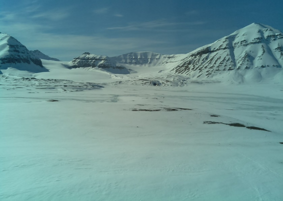
Longyearbyen will be used as a focal site due to easy access for researchers based in Svalbard and elsewhere. Processing data from many different cameras is time consuming, but establishing an optimised network using the same cameras and settings would enable fast and easy data processing using standard algorithms for e.g. snow cover. This has relevance across many fields of research as snow cover is central to a wide range of natural processes in Svalbard. The aim is to create a standard protocol that can be implemented by other researchers in new areas. Having such a standardised system will also make Svalbard more attractive as a cal / val site for e.g. ESA calls in the Arctic.
The project will raise the readiness level of the observations to provide new services. The project will develop a snow monitoring infrastructure and harmonise it between sites, taking it from data collection to a data service. The project will build on existing measurements but harmonise and optimise them to provide better data which will be shared with the wider scientific community through the SIOS data management system.
- processed time-series for snow cover fraction at Ny Alesund (2015-2021);
- development of data service prototype focused on retrieving the snow cover fraction from time-lapse cameras;
- data processing of terrestrial imagery obtained by time-lapse cameras at three pilot sites (2022);
- preparation of terrestrial SCF products for the SIOS catalogue.
- development of data service prototype focused on retrieving the snow cover fraction from time-lapse cameras;
- data processing of terrestrial imagery obtained by time-lapse cameras at three pilot sites (2022);
- preparation of terrestrial SCF products for the SIOS catalogue.
Norwegian Polar Institute (NPI, Norway);
NORCE (Norway);
Met.No (Norway);
UNIS (Norway);
IG-PAS (Poland);
CNR-IIA (Italy)
NORCE (Norway);
Met.No (Norway);
UNIS (Norway);
IG-PAS (Poland);
CNR-IIA (Italy)
Roberto Salzano
Giulio Esposito
Tiziana Davanzo
Lena Rettori
https://sios-svalbard.org/SnowPilot2022
